Cadastral Maps focus on boundaries which map include street names, lot numbers etc. The example included is a map of residential area and the streets, small bodies of water, and highways. www.rpdata.com/news/images_rp/feature/mapping.jpg
Thematic Maps contain a basic theme or spatial pattern. For instance, the map in this example is provided by the U.S. Census bureau and its displays the population shifts over various years. The different color groupings corresponding to the different categories.
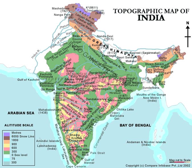
Here is an example of a topographic map of India. The uniqueness of topographic maps is that shows the contours of the land as well as bodies of water. In this example we see several bodies of water such as the Arabian Sea and Bay of Bengal.
Here is an image of a Planimetric map of Iraq. Planimetric maps are maps the focus on the horizontal features of a designated area. Notice that Irag is high lighted and there are various lines across the the country with data placed horizontally.


